Kalinga and Apayao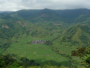
Kalinga and Apayao are provinces in the Philippines which are part of the Cordillera Administrative Region (CAR) located in the northern part of Luzon. This region is very mountainous since the Cordillera mountain range spans the entire length of the province. Even though the terrain is extremely mountainous and most of the region is located in a high altitude, the main source of livelihood is farming. Using the Kaingin system, Filipino farmers utilize the harsh terrain in order to grow rice.
The largest and most pressing issues in these provinces are education, healthcare, infrastructure, and electricity. Since Kalinga and Apayao are remote provinces in the Philippines, there are no electric lines that pass these provinces. As a result, all the households must use ineffective and dangerous kerosene lamps. Aside from this there is an insufficient amount of education and healthcare being provided. There is only one elementary school located in the provinces and no clinic. Majority of the populations would have a life expectancy of 65. However, contracting diseases would gravely decrease the life expectancy of individuals because of the lack of any proper healthcare facility. Aside from these issues, infrastructure has also become a large problem of the provinces. Being in a remote section of the country means that transportation of goods into the provinces would be difficult. Landslides causes by rains and typhoons would block the roads.
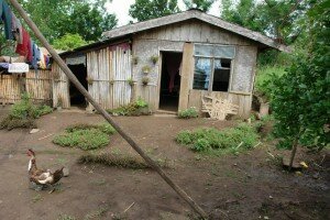 Mountain Province
Mountain Province is located in the northern area of the Philippines. As the name might suggest this area is very mountainous having part of the Cordillera mountain range cut through the province. The Mountain Province is located in a rather far-flung area. This has made the ability to provide a stable flow of electricity to most of the households impossible. More that 96% of the households are forced to use alternative lighting sources such are kerosene lamps.
This province is located in the mountainous portion of Luzon. This makes farming the main source of livelihood in this area. Because of its isolation, there is barely any employment outside farming and fishing. This creates a high poverty incidence reaching up to 96% of the population. Even though the area is mountainous and far-flung, education and healthcare is adequate although there would be much room for improvement. The province has a total of 7 schools providing education until the secondary level. However, the province also has certain barangays or communities that have no access to the educational system.
The Mountain Province also provides an adequate level of healthcare in certain areas of the region. However, due to the mountainous terrain, certain areas have no access to such healthcare facilities. This makes diseases such as Dengue, Malaria, Pneumonia, and Upper Respiratory Tract Infection prevalent and fatal illnesses. The life expectancy in these areas with no healthcare drops due to many causes where patients would not be able to receive proper medical treatment. This is either due to the lack of services provided or even the lack of money the locals can pay to receive such treatment.
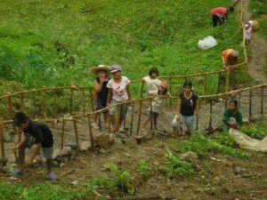 Oriental Mindoro
Oriental Mindoro is located off the coast of Luzon as part of region IVB. It is the seventh largest island in the Philippines and is located near the South China Sea and the Sulu Sea. The poverty in this province is extremely high reaching up to 96% of the population. This forces people to build houses out of cheaper and less durable material such as nipa, cogon, GI sheets, weaved coconut, leaves, and wood.
Due to its isolation from Luzon, there is barely any electricity provided for in the province. Instead, locals use almasigan lawaan oil and kerosene to light lamps. Aside from this the province faces a lack of clean water and sanitation in certain areas due to their isolation.
Healthcare and education provide an abysmal level of service. The educational system offers only two schools with the highest education provided being grade 6. This causes a low level of literacy rate reaching as low as 48%. The healthcare of the province also offers inadequate service. There is no proper healthcare facility. This allows Diarrhea, Gastritis, Anemia, and Broncho-pneumonia to become prevalent within the populace.
Because of the poor management of its natural resources, landslides have also become a problem for the province. The province experiences an average of 6 landslides each year caused by the high levels of deforestation on the mountainous areas of Oriental Mindoro. These landslides usually cripple roads and infrastructure causing problems with the transportation of good.
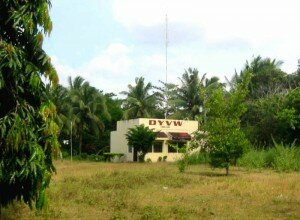 East Samar
East Samar is located in the island of Samar which is one of the larger islands found in the section of the Philippine archipelago called the Visayas. The island faces the Philippine sea and the Pacific ocean making it susceptible to frequent typhoons. This problem is worsened by the fact that common housing materials used would be bamboo, cogon, and wood which would easily be destroyed by typhoons. Eastern Samar is located in a rather far-flung area. This has made the ability to provide a stable flow of electricity to most of the households impossible. More that 99% of the households are forced to use alternative lighting sources such are kerosene lamps.
Being near the coast and having some flat land means that farming and fishing have become the two main sources of income. However, there is a grave lack of employment outside these two fields. This creates a high poverty incidence of 80%. Because of the high levels of poverty there is also an inadequate access to clean water.
However, services such as healthcare and education are accessible throughout the region. Having 10 schools which provide until the secondary level, the locals have a high literacy rate of 95%. At the same time there is an adequate amount of healthcare provided since there are 7 clinics scattered throughout the region. Prevalent illnesses such as Acute Lung Respiratory Tract Infection, Pneumonia, Bronchitis, Diarrhea, Influenza, Hypertension, TB Respiratory, Lung Cancer, Measles, and Hypertension have become less fatal to the populace due to access to more advance medical procedures.
 Catanduanes
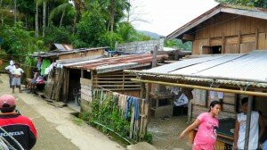
The community of “Dugui Wala” (literally “muddy left” in Bicol) actually refers to 2 baranggays now called “Dugui San Isidro” and “Dugui San Vicente.” These communities are located in the central mountainous region of the island-province of Catanduanes, within the boundaries of the capital town of Virac.
Being located in river embankments, these communities are reached by crossing the meandering river 17 to 27 times, depending on the water level. It is not surprising then that because of the indistinct wet and dry seasons of the island, the frequency of typhoons, as well as the increased rain fall due to global warming, these communities are frequently inaccessible by regular 4 wheel vehicles, so the best time to visit these communities are between March to June, when typically rainfall is the least. Because of this isolation, delivery of basic services, such as health, sanitation and education, remains a challenge for the Virac municipal government. As such, there have been proposals to relocate these communities, which has been met with resistance by the families living there, who argue that they have to close to their source of income, which is abaca.
Most of the families depend on abaca for their basic necessities. The typical family is composed of the father, who works as an abaca stripper, the mother, who works at home and raises vegetables and domesticated animals like pigs and chickens, and 3 to 7 children, above the provincial average of 3 children per family. Most start their families quite early, typically even before graduating from high school, the nearest of which is about an hour away by motorcycle, which entails going downriver with the typical 17 to 27 river crossings.
LIVELIHOOD. Catanduanes produces the best variety of abaca in the country, and presently accounts for about 40% of the nation’s production. Abaca plants grow in the mountainsides and resist the typhoons that typically batter the island. However, they may also be uprooted by strong winds, like the 300-kilometer per hour Reming which hit November 30, 2006. It takes abaca about 3 years to grow to a size that may be harvested for its fiber. Most of the abaca grow in government or privately-owned properties not owned by the abaca strippers.
Aside from abaca stripping, sources of livelihood include selling fruits, root crops or snails gathered from the forests surrounding the barangays. Villagers also raise pigs and chickens for their own consumption, typically for annual occasions like fiestas or Christmas, which are important events for them. Around half of the households live below the poverty line, as indicated by their inclusion in the government’s 4 Ps (Pantawid Pamilyang Pilipino Program) poverty-alleviation program.
HEALTH AND SANITATION. Though the barangay maintains a health center, this does not usually have any supplies like medicine. The sick have to be brought to the Rural Health Unit or the provincial hospital, around 2 to 4 hours away depending on the mode of transportation and the water level of the river. Houses do not have piped-in water and rely on around 4 deep-well pumps in the community for their water needs. There are only 2 public toilets in Dugui San Vicente; there are no private toilets.
ELECTRICITY. Dugui is already connected to the electric grid of Ficelco, or First Catanduanes Electric Cooperative. However, because of the high initial cost for connection, which is around PhP 8,000.00, and the prohibitive cost of electricity, at PhP 15 per kilowatt hour, the highest in the Bicol region, about less than half of the households are electrified, and the ones that are connected usually use electricity sparingly, usually only for one light bulb turned on from 6 pm to 9 pm only, which yields a monthly bill of over PhP 100. Only a few households have other electrical appliances, like a television or sound system. Wood is used for cooking, with most houses doing it indoors, which is possibly a reason why pneumonia and other respiratory diseases remain the number one cause of illness and death in the area.
 Rizal
Rizal
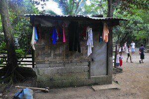
Barangay Puray, in Rodriguez, Rizal is home to around 1000 of the poorest people in the province. The barangay is very remote and isolated. To get to the area, one must go through the Mascap Mountain Range, and cross a river twice. There are only dirt roads leading to the area, making it inaccessible to all but trucks and 4×4 cars. It is around an hour’s drive out of the city proper of Antipolo.
The area has no access to electricity. Thus, they use kerosene lamps, candles, firewood and makeshift gas lamps to meet their lighting needs. To serve these lighting needs, they spend around 30% of their daily income. This is around P10 – P20 a day. However, this is still does next to nothing for these people. A typical day for these people start at 430 am, when the sun rises, and ends at 530 pm, when the sun sets.
During the daytime, these people make use of natural lighting or sunlight even within their homes. These homes are usually made of cogon, mud and bricks. The well-off homes are usually two stories with around four rooms – the kitchen/dining room, two bedrooms, and the bathroom. However, more common than not, houses are often composed of one room. This one room serves as the kitchen, bedroom and bathroom.
The average family size is composed of five to seven people. However, there is a very high infant mortality rate. More than 30% of children die before the age of ten. There is only one health center in the area. However, the midwife only comes in once a month. There is no doctor or nurse in the area. The sick must be transferred to the city for them to get access to medicine and proper facilities.
The average monthly income of a family is P1000. The common livelihood in the area includes hunting for baboy-damo, pag-uuling, goat raising, and planting coffee, bananas, vegetables, ube, camote and other produce. These products are sold in Tandang Sora, which is around two to three hours away from their barangay. Thus, by the time they to the market, many people have already bought so they are forced to sell their produce at cheaper prices.
On an average, these people spend P40 a day to feed their families. They eat mostly kamote, tuyo, and at times coffee with rice. If this is not the case, they eat the produce that they were not able to sell. There are other days, on the other hand, where families are not able to eat because they have no income.
The average educational attainment is grade school. Only a handful of people in the barangay have finished college. They have an elementary school within the barangay and a nearby high school. There are around 500 students in the elementary school, ranging from grades 1-6. Most children go to school, except for few who are asked by their parents to help out in the fields. However, oftentimes, by grade four or five, these children drop out of school. There are only three teachers to educate all of these students. These teachers’ educational attainment is high school level.


